Active Alerts and Current Conditions
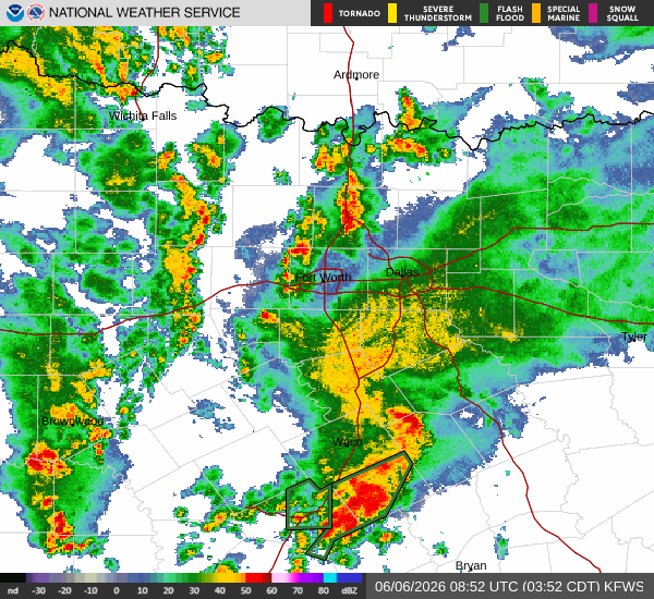
A severe Flood Watch is currently in effect for Howe, Texas, issued by the National Weather Service in Fort Worth. This alert remains active until 4:00 PM CDT on Sunday. The watch indicates that flooding is possible due to heavy rainfall, so residents should be prepared for rising water levels in low-lying and flood-prone areas.
It is currently Saturday overnight, and the atmosphere is already quite saturated. The air temperature sits at 73F, but the heat index makes it feel like 77F. Relative humidity is high at 92%, with a dew point of 71F, creating a muggy environment. Winds are blowing at 11 mph with gusts reaching 22 mph, and the sky is completely overcast. The National Weather Service forecasts showers and thunderstorms during this overnight period, with cloudy skies and a low around 71F. There is an 80% chance of precipitation, with new rainfall amounts between a quarter and half of an inch possible. South southeast winds will be around 5 mph.
Forecast for Today and Tomorrow
Today, the high will reach near 86F, with a low near 72F. The chance of precipitation is 39%, with dense drizzle expected. The National Weather Service notes that showers and thunderstorms are likely before 1pm, followed by a chance of showers and thunderstorms later. Skies will remain mostly cloudy, with a high near 82F according to their specific model, though local readings suggest near 86F. South southeast winds will range from 5 to 10 mph. There is an 80% chance of precipitation, with new rainfall amounts between three quarters and one inch possible.
Saturday night brings a chance of showers and thunderstorms before 1am, followed by likely showers and thunderstorms. The low will be around 71F. South winds will increase to around 10 mph. The chance of precipitation is 60%, with new rainfall amounts between three quarters and one inch possible.
Tomorrow, Sunday, the high will be near 86F, falling to around 84F in the afternoon, with a low near 69F. The chance of precipitation rises to 48%, with thunderstorms expected. Showers and thunderstorms are likely before 4pm, followed by a chance of showers and thunderstorms. Skies will be mostly cloudy. South winds will be 10 to 15 mph. There is an 80% chance of precipitation, with new rainfall amounts between a quarter and half of an inch possible.


