Active Alerts and Current Conditions
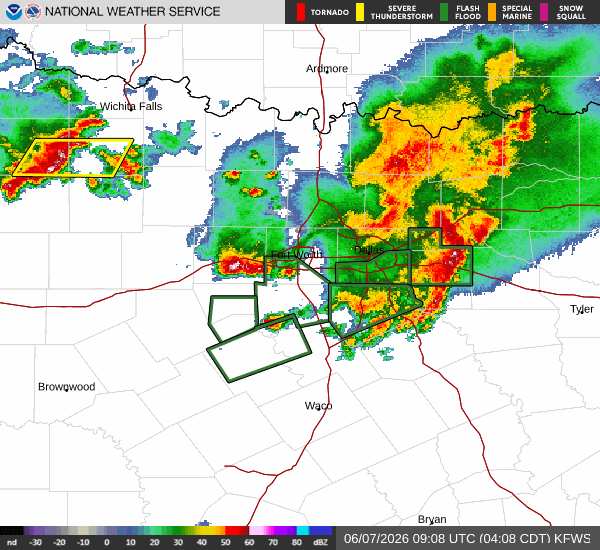
A severe Flood Watch is currently in effect for Howe, Texas, issued by the National Weather Service in Fort Worth. This alert remains active until 4:00 PM CDT on June 7. Residents should remain vigilant as conditions are favorable for significant rainfall and potential flooding.
It is currently Sunday overnight, and the area is experiencing rainy skies. The air temperature stands at 68F, with a feels-like temperature of 69F. Humidity is high at 91%, and the dew point is 66F. Winds are blowing from the south at 14 mph, with gusts reaching 17 mph.
Forecast for Today and Tomorrow
Today, the high will reach near 80F, with a low near 68F. There is a 64% chance of precipitation, with heavy rain expected. The National Weather Service indicates that showers and thunderstorms are likely before 1pm, followed by a slight chance of showers and thunderstorms between 1pm and 4pm. New rainfall amounts between a half and three quarters of an inch are possible. Heat index values may climb as high as 99. South winds will range from 10 to 15 mph, with gusts as high as 25 mph.
Tonight, skies will become partly cloudy with a low around 75F. South winds will continue around 15 mph, with gusts up to 25 mph.
Tomorrow, conditions will shift dramatically. The high will approach 89F, with a low near 75F. The chance of precipitation drops to just 2%, though thunderstorms are still possible. The sky will be mostly sunny. Heat index values could reach as high as 105. South winds will persist around 15 mph, with gusts as high as 25 mph.


