Back to Weather

5-day forecast / Howe, TX

WednesdaySunny98° / 76° 12%
ThursdaySlight Chance Rain Showers then Slight Chance Showers And Thunderstorms92° / 75° 22%
FridaySlight Chance Rain Showers95° / 75° 21%
SaturdaySunny97° / 76° 1%
SundaySunny98° / 77° 3%

Dangerous Heat Grips Howe as Temperatures Climb to 96F - Sep 2, 4 PM

Howe's hometown forecast, updated every four hours — straight from the National Weather Service.

Howe, TX faces dangerous heat today with a high near 96F and feels-like temperatures reaching 102F. A slight chance of rain arrives tomorrow.

Bree Tanaka

September 2, 20262 min read

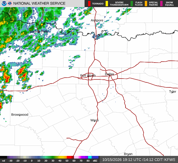
National Weather Service radar for North Texas (KFWS)

*As of Sep 2, 4 PM local time.*

Current Conditions and Heat Index

Dangerous heat is currently gripping Howe, Texas, as the afternoon sun beats down on the community. The air temperature stands at a sweltering 97F, but the heat index makes it feel like 101F. Relative humidity is at 37%, with a dew point of 66F.

Winds are light, blowing from the east at around 10 mph, though gusts may reach 12 mph. The sky remains partly cloudy despite the intense warmth.

Today and Tonight Forecast

Today will be sunny with a high near 96F. Heat index values are expected to climb as high as 102 during the peak afternoon hours. East winds will persist around 10 mph. There is no chance of precipitation today, leaving conditions dry but dangerously hot.

As evening approaches, skies will become mostly clear. Temperatures will drop to a low near 76F, though they may rise slightly to around 78F overnight. The heat index will remain elevated at values as high as 99. Winds will shift to the southeast, increasing to 10 to 15 mph.

Tomorrow Outlook

Conditions will begin to shift tomorrow with a slight chance of rain showers between 10am and 1pm. This will be followed by a slight chance of showers and thunderstorms later in the day. The sky will be partly sunny, with a high near 93F.
Heat index values are forecast to reach as high as 100. Southeast winds will continue at 10 to 15 mph, with gusts potentially hitting 25 mph. The chance of precipitation is 20%.

Tomorrow night brings a slight chance of showers and thunderstorms under partly cloudy skies. Lows will settle near 75F, rising to around 77F overnight. Heat index values will stay high at 99. South southeast winds will blow at 10 to 15 mph with gusts up to 25 mph. New rainfall amounts less than a tenth of an inch are possible.

Safety Reminder

With heat indices exceeding 100F, residents should prioritize hydration and limit midday exertion. Stay indoors during the hottest parts of the day and check on elderly neighbors or those without air conditioning. While no active weather alerts are in effect for Howe, the extreme heat poses significant health risks if precautions are not taken.

National Weather Service radar for North Texas (KFWS)

Sources

https://radar.weather.gov

https://api.weather.gov

https://open-meteo.com

Share

Bree Tanaka

Bree Tanaka covers weather, the outdoors, and seasonal life in and around Howe.

Related Stories

Weather

Howe Remains Hot and Dry as Tropical Storm Edouard Tracks South

Howe residents can expect continued heat and mostly sunny skies as Tropical Storm Edouard passes well to the south. Current temperatures are 90F, with highs near 100F today and a slight chance of brief showers.

Bree TanakaSeptember 1, 20262 min read

More in Sport